A total lunar eclipse of the full Worm Moon will sweep across the Pacific Ocean and western North America on March 2-3, 2026. The Blood Moon will be high in the sky for east Asia on the evening on March 3. East of the International Date Line – in Hawaii – the eclipse starts on the evening of March 2. Half a world away, in North America, we’ll have an early morning eclipse on March 3. We’ll be watching the eclipse as the Blood Moon sinks in the west before dawn. Japan, New Zealand, and most of Australia will see the entire event. From central Asia, the moon will rise with the eclipse already in progress. None of the eclipse will be visible from eastern Europe, Africa or western Asia.
And the next total lunar eclipse will be the total lunar eclipse on the morning of New Year’s Eve in 2028. It’s already being widely called the New Year’s Eve Blood Moon and it’ll occur on December 31, 2028.
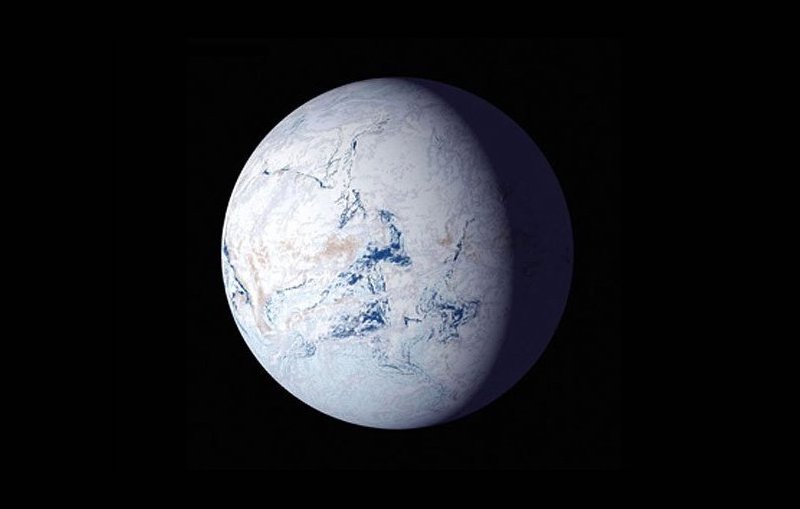
Total eclipses can turn the moon a deep shade of red. That’s why you’ll hear this eclipse called a Blood Moon eclipse. The shade of red on the moon will depend mostly on what’s happening Earth’s atmosphere at the moment of the eclipse. How dark red will the March 2026 total lunar eclipse be?


Eclipse details
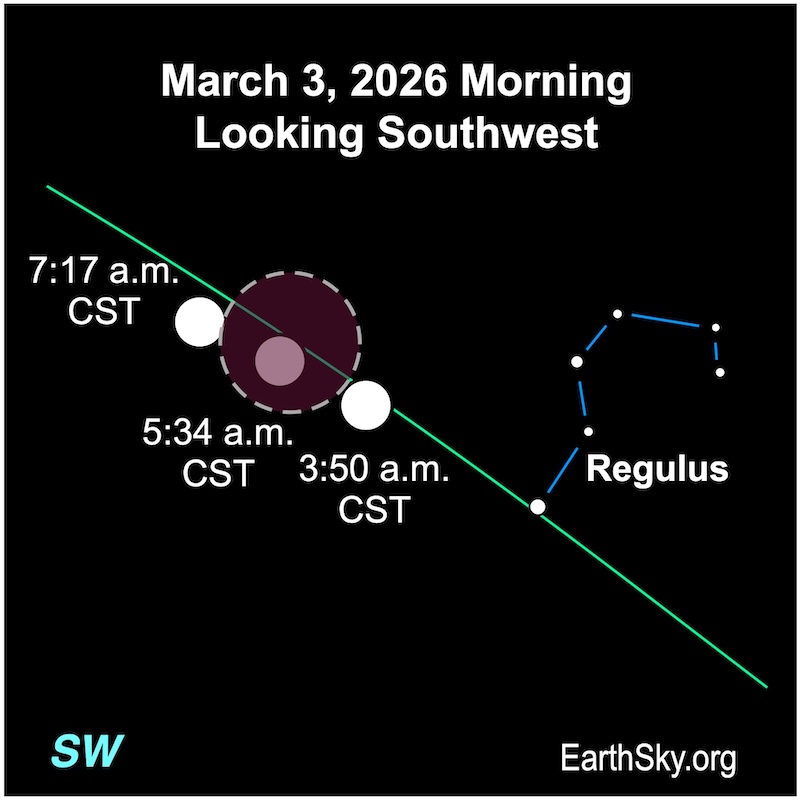
Full moon occurs at 11:38 UTC on March 3 (5:38 a.m. CST). That’s 35 minutes after totality begins.
Penumbral eclipse begins at 8:43:58 UTC (2:43 a.m. CST) on March 3.
Partial eclipse begins at 9:49:37 UTC (3:49 a.m. CST) on March 3.
Totality begins (moon engulfed in Earth’s shadow) begins at 11:03:54 UTC (5:03 a.m. CST) on March 3.
Maximum eclipse is at 11:33:40 UTC (5:33 a.m. CST) on March 3.
Totality ends at 12:02:53 UTC (6:02 a.m. CST) on March 3.
Partial eclipse ends at 13:17:26 UTC (7:17 a.m. CST) on March 3.
Penumbral eclipse ends at 14:23:19 UTC (8:23 a.m. CST) on March 3.
Duration of totality is about 59 minutes.
Note: A total lunar eclipse is when the sun, Earth and moon are aligned in space, with Earth in the middle. Earth’s shadow falls on the moon.
Also, lunar eclipses are safe to view with the unaided eye. Binoculars and telescopes – and a dark sky – enhance the view, but aren’t required.
Visit timeanddate.com to get eclipse timings from your location.
Moon, constellation, Saros
The moment of greatest eclipse takes place 6.5 days after the moon reaches perigee, its closest point from Earth for the month.
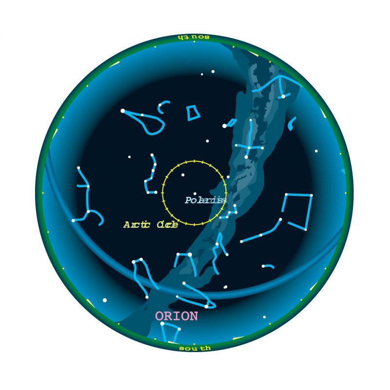
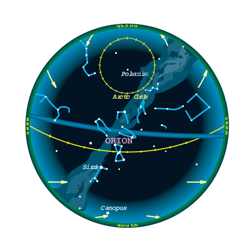
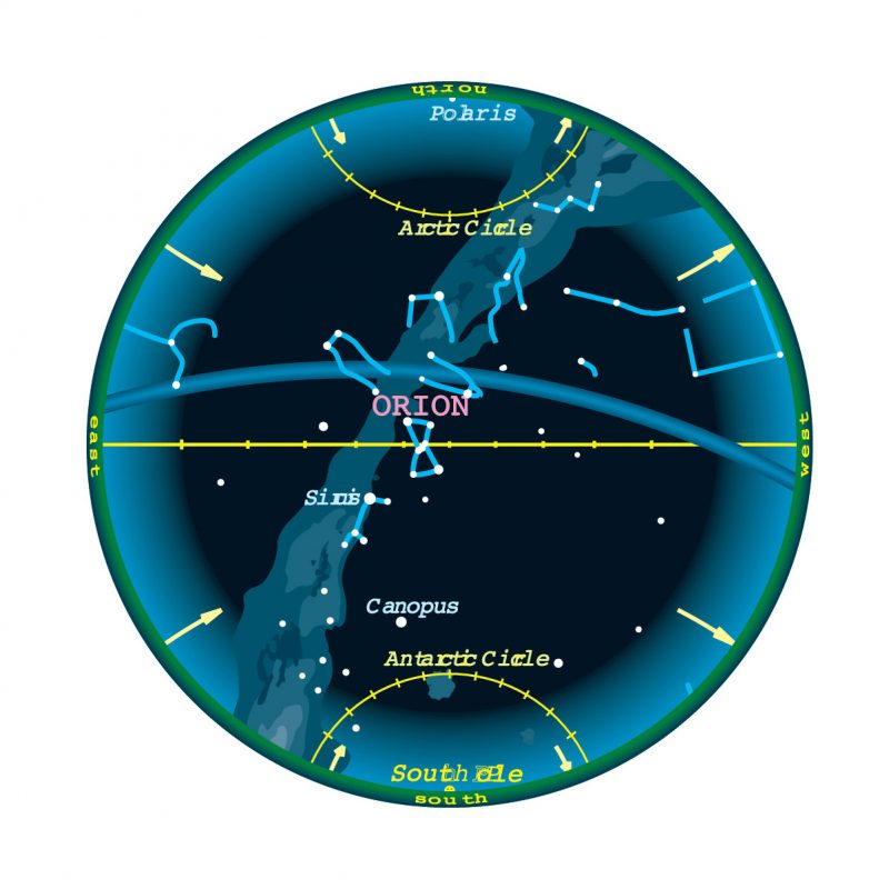
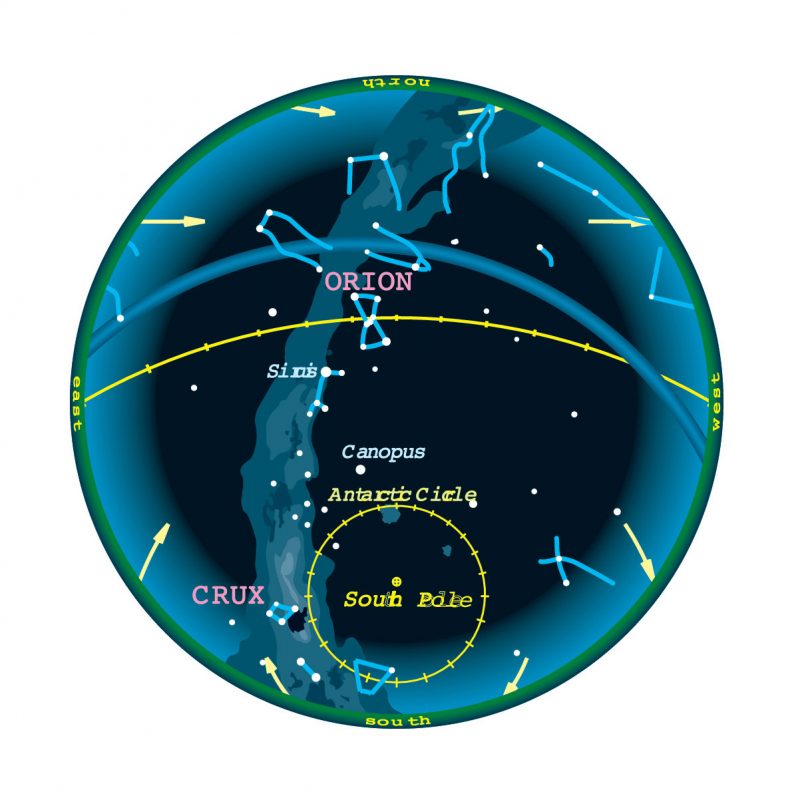
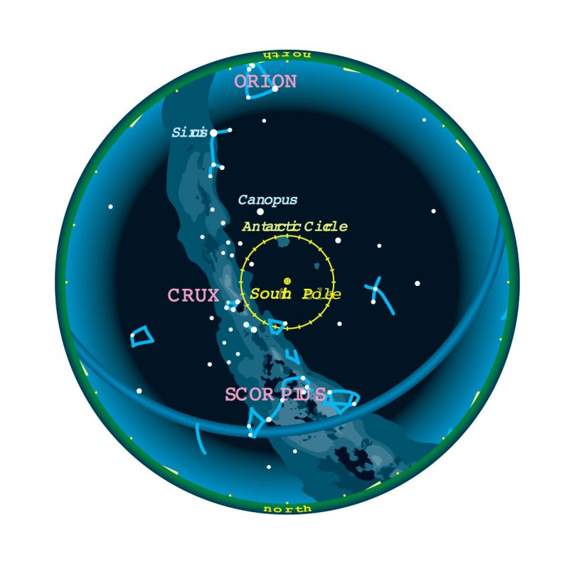
At mid-eclipse, the moon is located in the direction of the constellation Leo the Lion.
The Saros catalog describes the periodicity of eclipses. This March 3 total lunar eclipse belongs to Saros 133. It is number 27 of 71 eclipses in the series. All eclipses in this series occur at the moon’s descending node. The moon moves northward with respect to the node with each succeeding eclipse in the series.
The instant of greatest eclipse – when the axis of the Earth’s shadow cone passes closest to the moon’s center – takes place at 11:33 UTC on March 3. The moon will lie at zenith – directly overhead – in the Pacific Ocean.
Also, the duration of totality lasts 59 minutes!
Next eclipse of this eclipse seasons
This total lunar eclipse of March 3, 2026, was preceded two weeks earlier by an annular solar eclipse on February 17, 2026. These eclipses all take place during a single eclipse season.
An eclipse season is an approximate 35-day period during which it’s inevitable for at least two (and possibly three) eclipses to take place. In 2026 we have another eclipse season in August with a total solar eclipse on August 12 and a partial lunar eclipse on August 28.
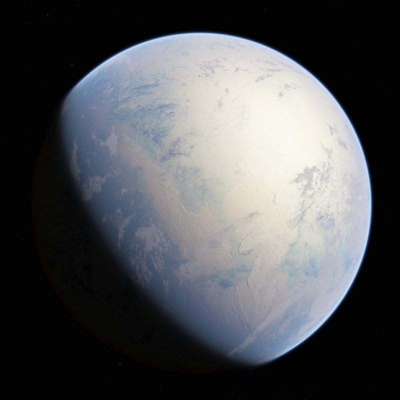
March full moon is the Worm MoonThe 2026 March full moon is the Worm Moon. All the full moons have popular nicknames. Popular names for the March full moon are Worm Moon, Crow Moon and Sap Moon. The name Worm Moon honors the stirring of earthworms and insect larvae in the slowly warming late winter and early spring soil.
Visit Sunrise Sunset Calendars to know the moonrise time, remembering to check the moonrise and moonset box.
March full moon is in LeoThe full moon on the night of March 3, 2026, is located in the direction of the constellation Leo the Lion. The moon is roundest on the day when it is full, but the day before and the day after, it appears almost, but not quite, full.
Total lunar eclipse maps and data
- Detailed Lunar Eclipse Figure: eclipse geometry diagram and map of eclipse visibility (key to figure)
- Saros 133 Table: data for all eclipses in the Saros series
- Danjon Scale of Lunar Eclipse Brightness
- Timeanddate.com eclipse map and animation
And the next total lunar eclipse is on December 31, 2028. It’ll be the first of three total lunar eclipses in a row. After the total eclipse on December 31, 2026, there will be one on June 26, 2029, and another one on December 20, 2029.
Bottom line: Overnight on March 2-3, 2026, there will be a total lunar eclipse of the March full Worm Moon visible from across northwest South America, North America, the Pacific Ocean, Australia, Asia, Japan, southeast Asia, China, India, and most of Russia.
Read more: A total lunar eclipse looks red. Why?
EarthSky’s monthly night sky guide: Visible planets and more
The post Total lunar eclipse: March 2-3 of the full Worm Moon first appeared on EarthSky.
from EarthSky https://ift.tt/tp9vVZ1
A total lunar eclipse of the full Worm Moon will sweep across the Pacific Ocean and western North America on March 2-3, 2026. The Blood Moon will be high in the sky for east Asia on the evening on March 3. East of the International Date Line – in Hawaii – the eclipse starts on the evening of March 2. Half a world away, in North America, we’ll have an early morning eclipse on March 3. We’ll be watching the eclipse as the Blood Moon sinks in the west before dawn. Japan, New Zealand, and most of Australia will see the entire event. From central Asia, the moon will rise with the eclipse already in progress. None of the eclipse will be visible from eastern Europe, Africa or western Asia.
And the next total lunar eclipse will be the total lunar eclipse on the morning of New Year’s Eve in 2028. It’s already being widely called the New Year’s Eve Blood Moon and it’ll occur on December 31, 2028.
Total eclipses can turn the moon a deep shade of red. That’s why you’ll hear this eclipse called a Blood Moon eclipse. The shade of red on the moon will depend mostly on what’s happening Earth’s atmosphere at the moment of the eclipse. How dark red will the March 2026 total lunar eclipse be?
Eclipse details
Full moon occurs at 11:38 UTC on March 3 (5:38 a.m. CST). That’s 35 minutes after totality begins.
Penumbral eclipse begins at 8:43:58 UTC (2:43 a.m. CST) on March 3.
Partial eclipse begins at 9:49:37 UTC (3:49 a.m. CST) on March 3.
Totality begins (moon engulfed in Earth’s shadow) begins at 11:03:54 UTC (5:03 a.m. CST) on March 3.
Maximum eclipse is at 11:33:40 UTC (5:33 a.m. CST) on March 3.
Totality ends at 12:02:53 UTC (6:02 a.m. CST) on March 3.
Partial eclipse ends at 13:17:26 UTC (7:17 a.m. CST) on March 3.
Penumbral eclipse ends at 14:23:19 UTC (8:23 a.m. CST) on March 3.
Duration of totality is about 59 minutes.
Note: A total lunar eclipse is when the sun, Earth and moon are aligned in space, with Earth in the middle. Earth’s shadow falls on the moon.
Also, lunar eclipses are safe to view with the unaided eye. Binoculars and telescopes – and a dark sky – enhance the view, but aren’t required.
Visit timeanddate.com to get eclipse timings from your location.
Moon, constellation, Saros
The moment of greatest eclipse takes place 6.5 days after the moon reaches perigee, its closest point from Earth for the month.
At mid-eclipse, the moon is located in the direction of the constellation Leo the Lion.
The Saros catalog describes the periodicity of eclipses. This March 3 total lunar eclipse belongs to Saros 133. It is number 27 of 71 eclipses in the series. All eclipses in this series occur at the moon’s descending node. The moon moves northward with respect to the node with each succeeding eclipse in the series.
The instant of greatest eclipse – when the axis of the Earth’s shadow cone passes closest to the moon’s center – takes place at 11:33 UTC on March 3. The moon will lie at zenith – directly overhead – in the Pacific Ocean.
Also, the duration of totality lasts 59 minutes!
Next eclipse of this eclipse seasons
This total lunar eclipse of March 3, 2026, was preceded two weeks earlier by an annular solar eclipse on February 17, 2026. These eclipses all take place during a single eclipse season.
An eclipse season is an approximate 35-day period during which it’s inevitable for at least two (and possibly three) eclipses to take place. In 2026 we have another eclipse season in August with a total solar eclipse on August 12 and a partial lunar eclipse on August 28.
March full moon is the Worm MoonThe 2026 March full moon is the Worm Moon. All the full moons have popular nicknames. Popular names for the March full moon are Worm Moon, Crow Moon and Sap Moon. The name Worm Moon honors the stirring of earthworms and insect larvae in the slowly warming late winter and early spring soil.
Visit Sunrise Sunset Calendars to know the moonrise time, remembering to check the moonrise and moonset box.
March full moon is in LeoThe full moon on the night of March 3, 2026, is located in the direction of the constellation Leo the Lion. The moon is roundest on the day when it is full, but the day before and the day after, it appears almost, but not quite, full.
Total lunar eclipse maps and data
- Detailed Lunar Eclipse Figure: eclipse geometry diagram and map of eclipse visibility (key to figure)
- Saros 133 Table: data for all eclipses in the Saros series
- Danjon Scale of Lunar Eclipse Brightness
- Timeanddate.com eclipse map and animation
And the next total lunar eclipse is on December 31, 2028. It’ll be the first of three total lunar eclipses in a row. After the total eclipse on December 31, 2026, there will be one on June 26, 2029, and another one on December 20, 2029.
Bottom line: Overnight on March 2-3, 2026, there will be a total lunar eclipse of the March full Worm Moon visible from across northwest South America, North America, the Pacific Ocean, Australia, Asia, Japan, southeast Asia, China, India, and most of Russia.
Read more: A total lunar eclipse looks red. Why?
EarthSky’s monthly night sky guide: Visible planets and more
The post Total lunar eclipse: March 2-3 of the full Worm Moon first appeared on EarthSky.
from EarthSky https://ift.tt/tp9vVZ1