
What is a derecho?
Derecho is a term weather-watchers like to throw around a lot in the summer. But what is it? It’s a take on the Spanish word derecho which can mean straight ahead. A derecho in meteorology is a widespread, long-lived windstorm. It’s associated with a line of fast-moving thunderstorms that causes damage for more than 240 miles (385 km) and contains winds of 58 mph (93 kph) or greater along most the length of the storm’s path.
Derechos are the result of downburst clusters, or groups of downbursts. These downbursts are strong damaging wind gusts in a thunderstorm moving downward. An individual downburst can be up to 6 miles (10 km) in size, while a downburst cluster can be up to 60 miles (100 km) long. The damage that derechos produce is due to straight-line winds, as opposed to the swirling winds of a tornado.
Sometimes people mistakenly call derechos “inland hurricanes” or even large tornadoes. But neither of these are true. Hurricanes form over warm ocean water. Meanwhile, derechos can produce hurricane-force winds and form over land, usually as a complex of thunderstorms before strengthening further. And the widest tornado on record in the United States was 2.6 miles wide. That’s far smaller than the hundreds of miles wide some derechos can be. We’ve talked a bit of what they are, as well as what they aren’t … so how does a complex of thunderstorms become a derecho?
How do derechos form?
A thunderstorm has a series of updrafts and downdrafts. As the downdraft, which is rain-cooled, reaches the ground, it spreads out. This burst of cooler air is the gust front, sometimes called an outflow boundary. While it can signify a storm is starting to collapse, it can also help fuel more storm development.
The gust front can act as a mini-cold front, forcing warm, humid air up into the sky. And this creates rising motion and prompts the development of another thunderstorm. As that storm gets stronger, it also produces rain-cooled air, strengthening the gust front. This creates an inflow that tilts the updraft of the thunderstorms. Then, the storms expand, producing more rain, which cools more air, which makes the gust front stronger, which causes the thunderstorms to bow out. When thunderstorms bow out, they are called bow echoes, because as those strong winds reach the ground they spread out.
We explain how bow echoes are formed because derechos typically start out as bow echoes. This process can continue across hundreds of miles for hours at a time, impacting thousands – and sometimes even millions – of people.

When is derecho season?
Like most thunderstorm-related severe weather, derechos are most common in the warmer months, typically May through August. In fact, nearly 70% of all derechos in the United States occur during this period. To break it down farther, 22% happen in May, 20% in June and 21% in July. Like any severe weather, though, derechos can happen at any time, even during the cooler months.
Serial derechos are more likely to occur in the cooler months. A serial derecho comes from multiple bow echoes in a large line that can be hundreds of miles long. It often covers a very wide and long area. In the cooler months, these serial derechos will most likely develop from eastern Texas toward the southeast.
Progressive derechos are most common in the warm season. While they can travel hundreds of miles, a progressive derecho is usually narrower, as small as 40 miles (65 km) wide. They can also start narrow and grow to be hundreds of miles wide. Most progressive derechos will occur in the northern Plains and Upper Midwest of the United States.

How to prepare for derechos
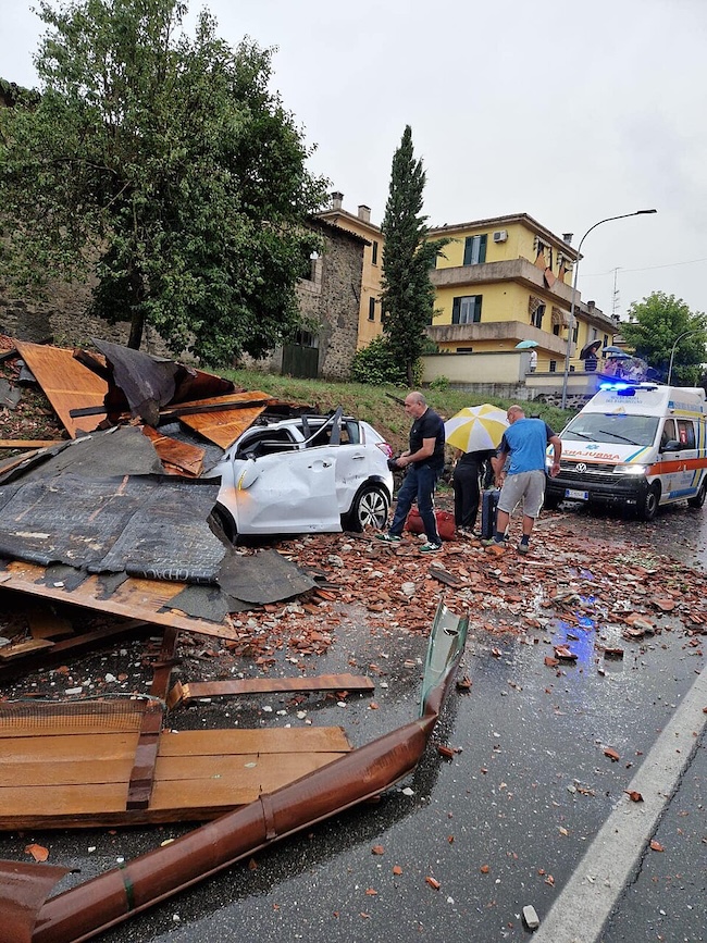
According to NOAA, derechos kill more people than EF0 and EF1 tornadoes combined, and EF0 and EF1 tornadoes make up 80% of all recorded tornadoes! While tornadoes can cause significant destruction, derechos can cause a wide path of destruction and move into communities at 60 to 70 miles per hour (about 96 to 112 kph).
Roughly half of all recorded derecho deaths were people in vehicles or boats. The boat deaths were typically because the boat overturned due to high winds, causing drowning. The vehicle deaths are due to higher profile vehicles blowing over and smaller cars driven into trees, or, often, trees falling on vehicles.
This is why you need to be prepared. If a derecho is occurring, it will fall under a “Severe Thunderstorm Warning” issued by your local National Weather Service office. Derechos can catch people off guard because they move fast. So no matter what your plans are, but especially if you plan to be outside: Always check the weather!
Get weather alerts
If you plan to be outside, have emergency alerts on your mobile device turned on, or bring a mobile weather radio with you. If you plan on being inside: also have emergency alerts turned on on your mobile device, and have a weather radio turned on. While derechos and tornadoes are not the same, if a severe thunderstorm warning is issued for a derecho, take cover inside a sturdy shelter, in a lower floor like you would during a tornado, away from all windows and outside walls. This will best protect you should strong winds blow out windows or a tree falls on your property.
Bottom line: Derechos are fast-moving, widespread wind storms that can produce wind gusts of hurricane-force. They are more common during the warm months of the year in the United States.
Read more: Be a storm spotter and help during severe weather
Read more: Notable derechos in recent history
The post What is a derecho? And when is derecho season? first appeared on EarthSky.
from EarthSky https://ift.tt/WkMaRqm
What is a derecho?
Derecho is a term weather-watchers like to throw around a lot in the summer. But what is it? It’s a take on the Spanish word derecho which can mean straight ahead. A derecho in meteorology is a widespread, long-lived windstorm. It’s associated with a line of fast-moving thunderstorms that causes damage for more than 240 miles (385 km) and contains winds of 58 mph (93 kph) or greater along most the length of the storm’s path.
Derechos are the result of downburst clusters, or groups of downbursts. These downbursts are strong damaging wind gusts in a thunderstorm moving downward. An individual downburst can be up to 6 miles (10 km) in size, while a downburst cluster can be up to 60 miles (100 km) long. The damage that derechos produce is due to straight-line winds, as opposed to the swirling winds of a tornado.
Sometimes people mistakenly call derechos “inland hurricanes” or even large tornadoes. But neither of these are true. Hurricanes form over warm ocean water. Meanwhile, derechos can produce hurricane-force winds and form over land, usually as a complex of thunderstorms before strengthening further. And the widest tornado on record in the United States was 2.6 miles wide. That’s far smaller than the hundreds of miles wide some derechos can be. We’ve talked a bit of what they are, as well as what they aren’t … so how does a complex of thunderstorms become a derecho?
How do derechos form?
A thunderstorm has a series of updrafts and downdrafts. As the downdraft, which is rain-cooled, reaches the ground, it spreads out. This burst of cooler air is the gust front, sometimes called an outflow boundary. While it can signify a storm is starting to collapse, it can also help fuel more storm development.
The gust front can act as a mini-cold front, forcing warm, humid air up into the sky. And this creates rising motion and prompts the development of another thunderstorm. As that storm gets stronger, it also produces rain-cooled air, strengthening the gust front. This creates an inflow that tilts the updraft of the thunderstorms. Then, the storms expand, producing more rain, which cools more air, which makes the gust front stronger, which causes the thunderstorms to bow out. When thunderstorms bow out, they are called bow echoes, because as those strong winds reach the ground they spread out.
We explain how bow echoes are formed because derechos typically start out as bow echoes. This process can continue across hundreds of miles for hours at a time, impacting thousands – and sometimes even millions – of people.
When is derecho season?
Like most thunderstorm-related severe weather, derechos are most common in the warmer months, typically May through August. In fact, nearly 70% of all derechos in the United States occur during this period. To break it down farther, 22% happen in May, 20% in June and 21% in July. Like any severe weather, though, derechos can happen at any time, even during the cooler months.
Serial derechos are more likely to occur in the cooler months. A serial derecho comes from multiple bow echoes in a large line that can be hundreds of miles long. It often covers a very wide and long area. In the cooler months, these serial derechos will most likely develop from eastern Texas toward the southeast.
Progressive derechos are most common in the warm season. While they can travel hundreds of miles, a progressive derecho is usually narrower, as small as 40 miles (65 km) wide. They can also start narrow and grow to be hundreds of miles wide. Most progressive derechos will occur in the northern Plains and Upper Midwest of the United States.
How to prepare for derechos
According to NOAA, derechos kill more people than EF0 and EF1 tornadoes combined, and EF0 and EF1 tornadoes make up 80% of all recorded tornadoes! While tornadoes can cause significant destruction, derechos can cause a wide path of destruction and move into communities at 60 to 70 miles per hour (about 96 to 112 kph).
Roughly half of all recorded derecho deaths were people in vehicles or boats. The boat deaths were typically because the boat overturned due to high winds, causing drowning. The vehicle deaths are due to higher profile vehicles blowing over and smaller cars driven into trees, or, often, trees falling on vehicles.
This is why you need to be prepared. If a derecho is occurring, it will fall under a “Severe Thunderstorm Warning” issued by your local National Weather Service office. Derechos can catch people off guard because they move fast. So no matter what your plans are, but especially if you plan to be outside: Always check the weather!
Get weather alerts
If you plan to be outside, have emergency alerts on your mobile device turned on, or bring a mobile weather radio with you. If you plan on being inside: also have emergency alerts turned on on your mobile device, and have a weather radio turned on. While derechos and tornadoes are not the same, if a severe thunderstorm warning is issued for a derecho, take cover inside a sturdy shelter, in a lower floor like you would during a tornado, away from all windows and outside walls. This will best protect you should strong winds blow out windows or a tree falls on your property.
Bottom line: Derechos are fast-moving, widespread wind storms that can produce wind gusts of hurricane-force. They are more common during the warm months of the year in the United States.
Read more: Be a storm spotter and help during severe weather
Read more: Notable derechos in recent history
The post What is a derecho? And when is derecho season? first appeared on EarthSky.
from EarthSky https://ift.tt/WkMaRqm
Aucun commentaire:
Enregistrer un commentaire