A new coral reef atlas
Researchers said on September 8, 2021, that they used more than 2 million satellite images of Earth to complete a new comprehensive online map of the world’s coral reefs. The Allen Coral Atlas is named after late Microsoft co-founder Paul Allen. You can explore it here. The Atlas’ website said that it’ll:
… [open] new doors for targeted action.
and
… act as a reference for reef conservation, marine planning and coral science as researchers try to save these fragile ecosystems that are being lost to climate change.
The Allen Coral Atlas includes habitat maps of the world’s tropical, shallow coral reefs between 30 degrees north and 30 degrees south latitude. The maps include areas up to 50 feet (15 meters) deep. A habitat map is one that shows the various plants, animals, and/or their surroundings in a certain area, in this case, under the sea.
Explore the new Allen Coral Atlas here
The reearchers said:
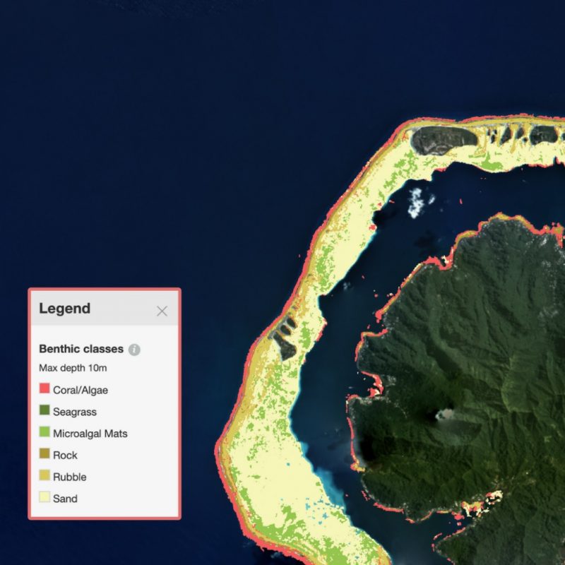
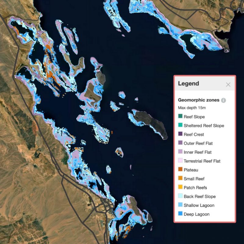
By combining satellite imagery, advanced analytics, and object-based analysis, global collaboration has resulted in maps that show the marine ecosystem’s benthic and geomorphic data in unprecedented detail.
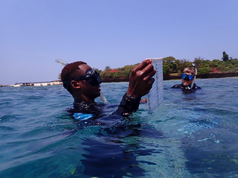
The term “benthic” refers to the composition of the ocean floor while “geomorphic” refers to the seascape, or the structure, of the ocean floor, these scientists said. Michael Markovina, who previously directed the Marine Program for Wildlife Conservation Society Tanzania, helped collect field data for the Atlas. He recalled the experience, saying:
To someone who has never seen the reef, it is like looking at a city from a helicopter. Lots of activity, color, shapes, and the buildings teeming with life and activity inside. Also, when you look at a devastated reef, it looks like a bombed city in Syria. The very components that make you go ‘wow’ at the sight of a beautiful functioning city are missing and lying in ruin. It is very impactful.
Wen Wen, a marine spatial analyst in Indonesia, explained:
We now have the highly detailed maps needed to create new spatial plans and marine protected areas. The Allen Coral Atlas is playing a large role in prioritizing 30 million hectares [about 116,000 square miles] … and providing alternative locations for a coastal economic development project of a shoreline airport [here in Indonesia].
He added:
This tool is a blessing to our country.
Many scientists from different institutions worked together to create the new atlas. They said they leveraged machine learning and advanced analyses. Their statement explained:
Over 450 datasets and existing local reef maps have been provided by research and conservation teams. These data support the Atlas maps at various stages – from training the algorithms to accurately recognize and classify a reef area to assessing the quality of the Atlas habitat maps.
After the regions have been validated and feedback is provided by a local expert, the habitat maps are sent to the software engineering team at [Arizona State University’s Center for Global Discovery and Conservation Science, or GDCS], where the global habitat maps are transformed into visual and downloadable data available to anyone with internet access.
Greg Asner, managing director of the Atlas and director of GDCS, told ABC News:
Our biggest contribution in this achievement is that we have a uniform mapping of the entire coral reef biome.
Read more via Allencoralatlas.org
Bottom line: The new global map of coral reefs is the first global, high-resolution map of its kind. It presents details on the composition and structure of the ocean floor.
The post A new coral reef atlas you can explore first appeared on EarthSky.
from EarthSky https://ift.tt/3lg0W31
A new coral reef atlas
Researchers said on September 8, 2021, that they used more than 2 million satellite images of Earth to complete a new comprehensive online map of the world’s coral reefs. The Allen Coral Atlas is named after late Microsoft co-founder Paul Allen. You can explore it here. The Atlas’ website said that it’ll:
… [open] new doors for targeted action.
and
… act as a reference for reef conservation, marine planning and coral science as researchers try to save these fragile ecosystems that are being lost to climate change.
The Allen Coral Atlas includes habitat maps of the world’s tropical, shallow coral reefs between 30 degrees north and 30 degrees south latitude. The maps include areas up to 50 feet (15 meters) deep. A habitat map is one that shows the various plants, animals, and/or their surroundings in a certain area, in this case, under the sea.
Explore the new Allen Coral Atlas here
The reearchers said:
By combining satellite imagery, advanced analytics, and object-based analysis, global collaboration has resulted in maps that show the marine ecosystem’s benthic and geomorphic data in unprecedented detail.
The term “benthic” refers to the composition of the ocean floor while “geomorphic” refers to the seascape, or the structure, of the ocean floor, these scientists said. Michael Markovina, who previously directed the Marine Program for Wildlife Conservation Society Tanzania, helped collect field data for the Atlas. He recalled the experience, saying:
To someone who has never seen the reef, it is like looking at a city from a helicopter. Lots of activity, color, shapes, and the buildings teeming with life and activity inside. Also, when you look at a devastated reef, it looks like a bombed city in Syria. The very components that make you go ‘wow’ at the sight of a beautiful functioning city are missing and lying in ruin. It is very impactful.
Wen Wen, a marine spatial analyst in Indonesia, explained:
We now have the highly detailed maps needed to create new spatial plans and marine protected areas. The Allen Coral Atlas is playing a large role in prioritizing 30 million hectares [about 116,000 square miles] … and providing alternative locations for a coastal economic development project of a shoreline airport [here in Indonesia].
He added:
This tool is a blessing to our country.
Many scientists from different institutions worked together to create the new atlas. They said they leveraged machine learning and advanced analyses. Their statement explained:
Over 450 datasets and existing local reef maps have been provided by research and conservation teams. These data support the Atlas maps at various stages – from training the algorithms to accurately recognize and classify a reef area to assessing the quality of the Atlas habitat maps.
After the regions have been validated and feedback is provided by a local expert, the habitat maps are sent to the software engineering team at [Arizona State University’s Center for Global Discovery and Conservation Science, or GDCS], where the global habitat maps are transformed into visual and downloadable data available to anyone with internet access.
Greg Asner, managing director of the Atlas and director of GDCS, told ABC News:
Our biggest contribution in this achievement is that we have a uniform mapping of the entire coral reef biome.
Read more via Allencoralatlas.org
Bottom line: The new global map of coral reefs is the first global, high-resolution map of its kind. It presents details on the composition and structure of the ocean floor.
The post A new coral reef atlas you can explore first appeared on EarthSky.
from EarthSky https://ift.tt/3lg0W31
Aucun commentaire:
Enregistrer un commentaire