
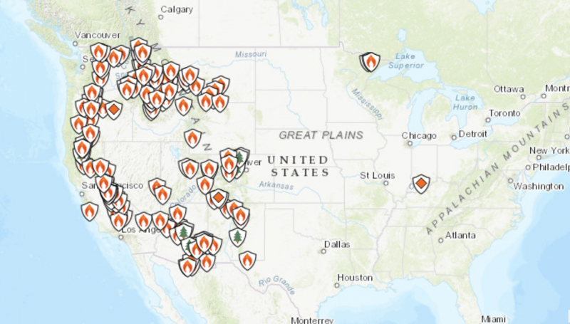
Smoke from wildfires in Canada and the western United States is blaneting North America. As of July 21, 2021, ais quality alerts had been issued even in the U.S. East, and, by mid-week, even New York City was blanketed with haze from wildfire smoke. The New York Times reported on July 21:
In recent weeks, a series of near-relentless heat waves and deepening drought linked to climate change have helped to fuel exploding wildfires. In southern Oregon, the Bootleg Fire grew so large and hot that it created its own weather, triggering lightning and releasing enormous amounts of smoke. But more than 80 large fires are currently burning across 13 American states, and many more are active across Canada.
See an animated smoke map of North America from July 21, 2021.

The video below is from NOAAA Satellites on July 15, 2021:
Meanwhile, earlier this week (July 19, 2021), extremely dangerous wildfire conditions were forecast in California and southern Oregon. Firefighters in both states were battling massive wildfires burning through numerous square miles, as shown in the video below:
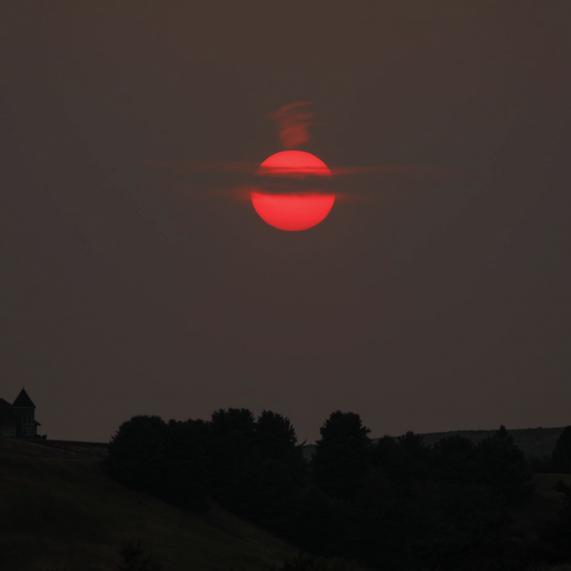
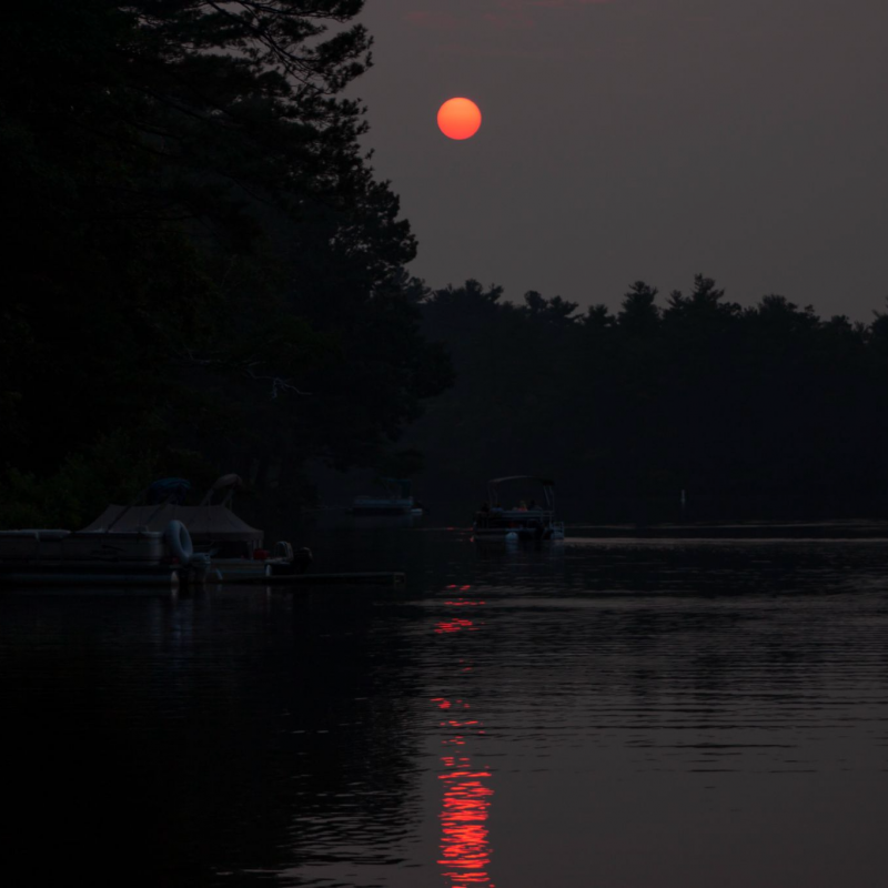
Bottom line: Wildfire smoke is blanketing North America, as of July 22, 2021. If you have an image of smoke or the effect of smoke on the sun or moon, you can submit it here.
The post Wildfire smoke blankets North American skies first appeared on EarthSky.
from EarthSky https://ift.tt/2Ut8mGR
Smoke from wildfires in Canada and the western United States is blaneting North America. As of July 21, 2021, ais quality alerts had been issued even in the U.S. East, and, by mid-week, even New York City was blanketed with haze from wildfire smoke. The New York Times reported on July 21:
In recent weeks, a series of near-relentless heat waves and deepening drought linked to climate change have helped to fuel exploding wildfires. In southern Oregon, the Bootleg Fire grew so large and hot that it created its own weather, triggering lightning and releasing enormous amounts of smoke. But more than 80 large fires are currently burning across 13 American states, and many more are active across Canada.
See an animated smoke map of North America from July 21, 2021.
The video below is from NOAAA Satellites on July 15, 2021:
Meanwhile, earlier this week (July 19, 2021), extremely dangerous wildfire conditions were forecast in California and southern Oregon. Firefighters in both states were battling massive wildfires burning through numerous square miles, as shown in the video below:
Bottom line: Wildfire smoke is blanketing North America, as of July 22, 2021. If you have an image of smoke or the effect of smoke on the sun or moon, you can submit it here.
The post Wildfire smoke blankets North American skies first appeared on EarthSky.
from EarthSky https://ift.tt/2Ut8mGR
Aucun commentaire:
Enregistrer un commentaire