

View at EarthSky Community Photos. | Michelle Berger in Sandpoint, Idaho, captured this photo of Kelvin-Helmholtz clouds on December 27, 2020. She wrote: “We were driving home one evening in December, two days after Christmas, and saw this beautiful image in the sky east of our way home.” Thank you, Michelle!
Clouds that imitate waves are rare and beautiful. These clouds – known variously as Kelvin-Helmholtz clouds, billow clouds, or shear-gravity clouds – might have been the inspiration for an Gogh’s painting VStarry Night. The next time you spot one of these remarkable wave clouds, capture a photograph and send it to us!
Kelvin-Helmholtz clouds are named for Lord Kelvin and Hermann von Helmholtz, who studied the physics of the instability that leads to this type of cloud formation. A Kelvin-Helmholtz instability forms where there’s a velocity difference across the interface between two fluids: for example, wind blowing over water.
When might you get to see these beautiful clouds? Your odds are better on windy days, when there’s a difference in densities of the air, for example, during a temperature inversion. You’re also more likely to see these clouds near sunrise or sunset, another time when the bottom of the clouds are cooler and the air above is warmer. The clouds take on this wave shape when the air above is moving more quickly than the air below, pushing over the tops of the clouds and creating the rolling wave appearance. As you might have guessed, Kelvin-Helmholtz clouds are a sign that aircraft in the area will be experiencing turbulence.
Enjoy our gallery of Kelvin-Helmholtz clouds!
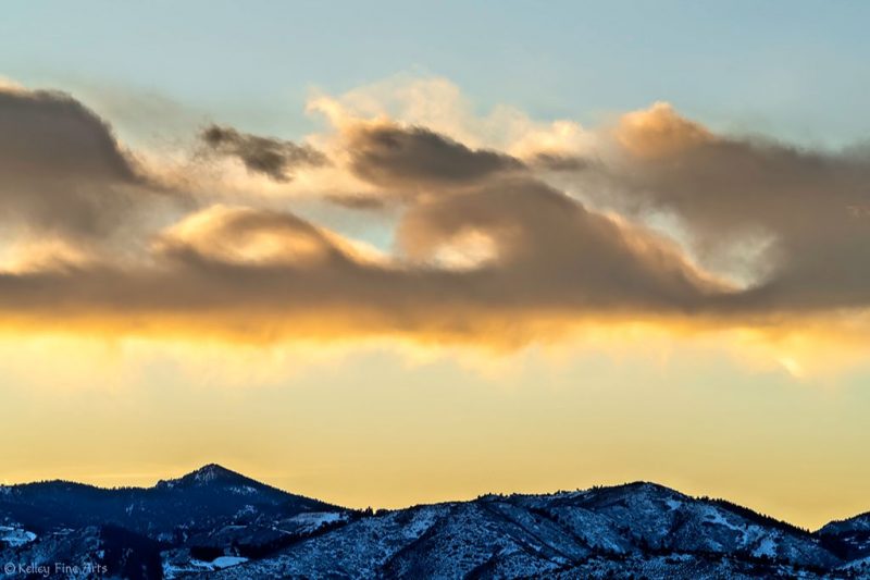
View at EarthSky Community Photos. | Suzanne Kelley of Littleton, Colorado caught these Kelvin-Helmholtz clouds – clouds that look like ocean waves – at sunset over the Rocky Mountains on New Year’s Eve, December 31, 2019. Thank you, Suzanne!
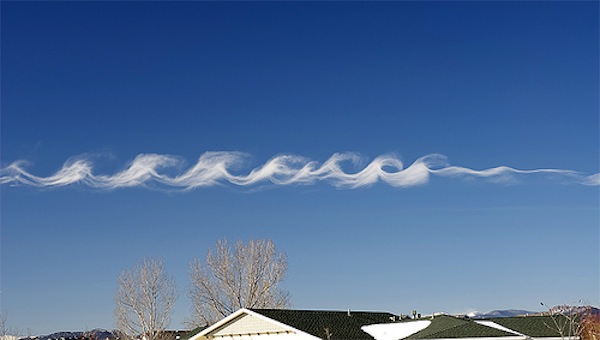
Surf in the sky via Yoav Naccache.
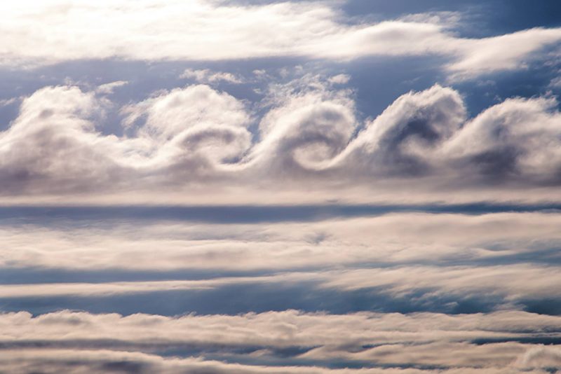
Kelvin-Helmholtz clouds seen in Tupper Lake, New York, in the Adirondack Mountains. Photo via Paul Chartier.

View larger. | EarthSky Facebook friend Risa Bender caught these Kelvin-Helmholtz clouds from Dallas, Texas.

Helio de Carvalho Vital caught these Kelvin-Helmholtz clouds over Rio de Janeiro, Brazil.
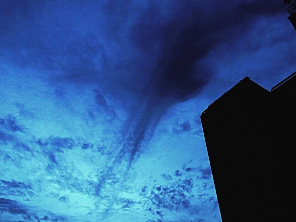
View larger. | Helio de Carvalho Vital also submitted this photo to EarthSky. It’s a Kelvin-Helmholtz effect in virga, or rain that falls but doesn’t reach the ground. He caught it in Rio de Janeiro, Brazil, on May 15, 2015.
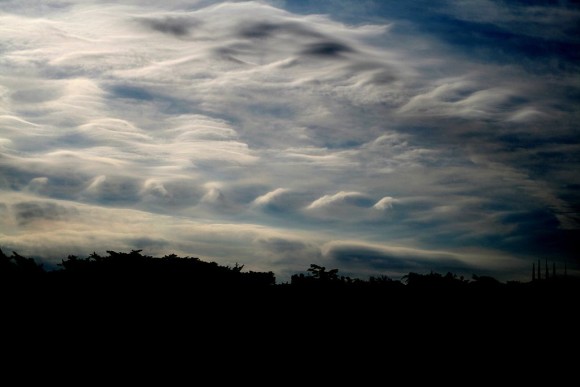
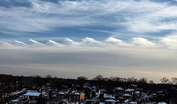
Kelvin-Helmholtz clouds seen over San Francisco. These clouds, sometimes called “billow clouds,” are produced by instability, when horizontal layers of air brush by one another at different velocities. Photo via Wikimedia Commons.
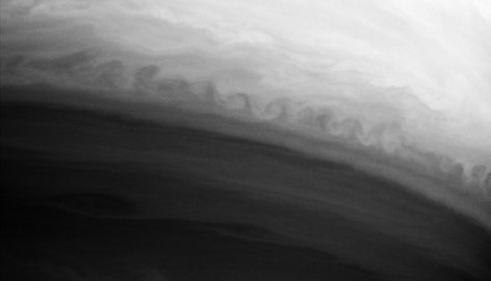
Earth isn’t the only planet with Kelvin-Helmholtz clouds. Here they are on Saturn; Jupiter has them, too. Image via Wikimedia Commons.
Bottom line: Clouds that take on the appearance of ocean waves are known as Kelvin-Helmholtz clouds. These clouds, also called billow or shear-gravity clouds, are created by winds moving at two different speeds.
from EarthSky https://ift.tt/2F7liXA


View at EarthSky Community Photos. | Michelle Berger in Sandpoint, Idaho, captured this photo of Kelvin-Helmholtz clouds on December 27, 2020. She wrote: “We were driving home one evening in December, two days after Christmas, and saw this beautiful image in the sky east of our way home.” Thank you, Michelle!
Clouds that imitate waves are rare and beautiful. These clouds – known variously as Kelvin-Helmholtz clouds, billow clouds, or shear-gravity clouds – might have been the inspiration for an Gogh’s painting VStarry Night. The next time you spot one of these remarkable wave clouds, capture a photograph and send it to us!
Kelvin-Helmholtz clouds are named for Lord Kelvin and Hermann von Helmholtz, who studied the physics of the instability that leads to this type of cloud formation. A Kelvin-Helmholtz instability forms where there’s a velocity difference across the interface between two fluids: for example, wind blowing over water.
When might you get to see these beautiful clouds? Your odds are better on windy days, when there’s a difference in densities of the air, for example, during a temperature inversion. You’re also more likely to see these clouds near sunrise or sunset, another time when the bottom of the clouds are cooler and the air above is warmer. The clouds take on this wave shape when the air above is moving more quickly than the air below, pushing over the tops of the clouds and creating the rolling wave appearance. As you might have guessed, Kelvin-Helmholtz clouds are a sign that aircraft in the area will be experiencing turbulence.
Enjoy our gallery of Kelvin-Helmholtz clouds!

View at EarthSky Community Photos. | Suzanne Kelley of Littleton, Colorado caught these Kelvin-Helmholtz clouds – clouds that look like ocean waves – at sunset over the Rocky Mountains on New Year’s Eve, December 31, 2019. Thank you, Suzanne!

Surf in the sky via Yoav Naccache.

Kelvin-Helmholtz clouds seen in Tupper Lake, New York, in the Adirondack Mountains. Photo via Paul Chartier.

View larger. | EarthSky Facebook friend Risa Bender caught these Kelvin-Helmholtz clouds from Dallas, Texas.

Helio de Carvalho Vital caught these Kelvin-Helmholtz clouds over Rio de Janeiro, Brazil.

View larger. | Helio de Carvalho Vital also submitted this photo to EarthSky. It’s a Kelvin-Helmholtz effect in virga, or rain that falls but doesn’t reach the ground. He caught it in Rio de Janeiro, Brazil, on May 15, 2015.

Kelvin-Helmholtz clouds seen over San Francisco. These clouds, sometimes called “billow clouds,” are produced by instability, when horizontal layers of air brush by one another at different velocities. Photo via Wikimedia Commons.

Earth isn’t the only planet with Kelvin-Helmholtz clouds. Here they are on Saturn; Jupiter has them, too. Image via Wikimedia Commons.
Bottom line: Clouds that take on the appearance of ocean waves are known as Kelvin-Helmholtz clouds. These clouds, also called billow or shear-gravity clouds, are created by winds moving at two different speeds.
from EarthSky https://ift.tt/2F7liXA

Aucun commentaire:
Enregistrer un commentaire