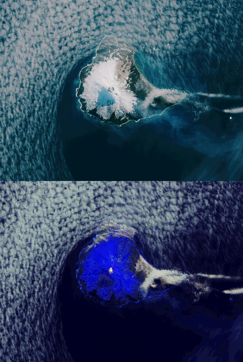

Mount Michael in the South Sandwich Islands, with its lava lake at the top of the volcano, as seen from space. Image via the Copernicus Sentinel-2 mission/ESA.
The European Space Agency (ESA) released this image on July 4, 2019 and said:
Mount Michael is an active stratovolcano on the remote Saunders Island, one of the South Sandwich Islands in the southern Atlantic Ocean. In situ observations of the volcano prove difficult owing to its remote location and the fact that it is almost 1,000 meters [about 3,000 feet] high and difficult to climb. However, modern satellite imagery can help survey isolated locations such as these.
In these images captured by the Copernicus Sentinel-2 mission on March 29, 2018, a distinct hotspot can be seen in orange in the crater of the volcano. The true-color image shows volcanic ash over the snow and smoke plumes coming from its crater, drifting south-eastwards.
The assessment of Mount Michael’s lava lake is presented in a recent report in Journal of Volcanology and Geothermal Research. By using modern satellites, including the U.S. Landsat, Copernicus Sentinel-2 and the U.S. Terra missions, monitoring activity and thermal anomalies within the crater is now possible.
The paper confirms that the rare lava lake is a continuous feature inside Mount Michael’s crater, with a temperature of approximately 1,000 degrees C [1,800 degrees F].
Only a handful of other volcanoes in the world are currently hosting persistent lava lakes – Masaya volcano, Mount Nyiragongo, Kilauea, Mount Erebus, Mount Yasur, Ambrym and Erta Ale.
Bottom line: Satellite image of rare lava lake.
from EarthSky https://ift.tt/2NLmhUz

Aucun commentaire:
Enregistrer un commentaire