aads

News digest – Tessa Jowell, cancer waiting times, immunotherapy, and how should we talk about cancer?

Cancer nurse staff

Tributes paid to Tessa Jowell

Tributes were paid this week following the death of Tessa Jowell from an aggressive brain tumour. As an MP she oversaw the 2012 Olympics, and in the House of Lords she campaigned for more funding for brain tumour research and treatment. In response, Teresa May announced government would double its spend on research into brain tumours, along with other commitments. Take a look at our news report for more, and the Evening Standard piece for the view of our chief executive on Jowell’s legacy.

Six months of Herceptin treatment ‘could be as effective as 12’

We reported on unpublished clinical trial results showing the proportion of women that were cancer free following treatment for HER2-positive early stage breast cancer was the same if they had a 6 or 12-month course of Herceptin. Side effects were also reduced in the 6-month group. The New York Times also had the story.

Immunotherapy might be less effective for women

Immunotherapy has shown promise for treating a range of cancers, but it might be less effective in women, reports the Telegraph. A review of trials found that immunotherapy is on average half as effective for women than men. The trials still found overall that the immunotherapies were superior than standard treatment in women, and the researchers behind the study suggested hormone differences might play a role.

Vegan group’s advert wrongly linking cow’s milk to cancer is banned

A vegan group’s advert wrongly linking cow’s milk to cancer has been banned. iNews reports on the Advertising Standards Authority’s decision, which said that linking the hormones to cancer was “misleading”.

Funding bias against female cancer researchers

Female scientists receive less than a quarter of cancer research funds, reports The Times (£). A study of nearly 3,000 grants from government departments and charities found that nearly 70% of awards and nearly 80% of money went to male lead researchers. Less than 20% of high-level medical researchers are women. Cancer Research UK funding wasn’t included in the study.

Some patients facing long waits for treatment

The longest waits for cancer tests and treatment are increasing, reports The Guardian. Nearly 70% of NHS trusts in England said they had a worse longest wait than in 2010, with one patient waiting a year and a half between GP referral and treatment. The official target in England requires at least 85% of cancer patients to have their first treatment within 62 days of an urgent referral by their GP, but this hasn’t been met for over two years.

Breath test spots oesophageal and stomach cancers

We reported on breath test could help speed up diagnosis of oesophageal and stomach cancers. The diseases are often diagnosed late when treatment is more difficult. Researchers trialled the breath test in a group of 335 patients, and larger patient groups will be used to see if the results hold up.

And finally

The perceived need to “fight” cancer and remain positive is having a negative effect on people living with the disease, reports The Guardian. It’s based on research from a charity that found the battle language sometimes used to talk about cancer and other diseases can stop patients talking openly, preventing them getting the best end of life care. We’ve talked before about how important language is at such a delicate time.


from Cancer Research UK – Science blog https://ift.tt/2Ixep1A

New research, May 7-13, 2018

A selection of new climate related research articles is shown below.

Climate change

Temperature, precipitation, wind

Comparing daily temperature averaging methods: the role of surface and atmosphere variables in determining spatial and seasonal variability

Dynamical analysis of extreme precipitation in the US northeast based on large-scale meteorological patterns

Projected change in characteristics of near surface temperature inversions for southeast Australia

Consequences of 1.5 °C and 2 °C global warming levels for temperature and precipitation changes over Central Africa

Unidirectional trends in annual and seasonal climate and extremes in Egypt

An asymmetric rainfall response to ENSO in East Asia

Mixed precipitation occurrences over southern Québec, Canada, under warmer climate conditions using a regional climate model

Extreme events

Estimation of the compound hazard severity of tropical cyclones over coastal China during 1949–2011 with copula function

The unique “Regional East Gale with Blowing Snow” natural disaster in Jeminay County, Xinjiang Uygur Autonomous Region, China

Post-disaster social recovery: disaster governance lessons learnt from Tropical Cyclone Yasi

Spatio-temporal quantitative links between climatic extremes and population flows: a case study in the Murray-Darling Basin, Australia

An analysis of the prevalence of heat waves in the United States between 1948 and 2015

"Results confirmed strong increase in the prevalence of heat waves between the mid-1970s and dataset end (2015), and that increase was preceded by mild decrease since dataset beginning (1948). Results were unclear whether the prevalence of nighttime or simultaneous daytime-nighttime heat waves increased the most, but were clear that increases were largest in the summer."

Climate Change and Drought: From Past to Future

Economic impacts of storm surge and the cost-benefit analysis of a coastal spine as the surge mitigation strategy in Houston-Galveston area in the USA

Forcings and feedbacks

The Impact of Stratospheric Ozone Feedbacks on Climate Sensitivity Estimates

Regional Climate Sensitivity‐ and Historical‐Based Projections to 2100

Reproducing Long‐Range Correlations in Global Mean Temperatures in Simple Energy Balance Models

A Revisit of Global Dimming and Brightening Based on the Sunshine Duration

Tropospheric jet response to Antarctic ozone depletion: An update with Chemistry-Climate Model Initiative (CCMI) models

Contrails and their impact on shortwave radiation and photovoltaic power production – a regional model study (open access)

Cryosphere

Ocean as the main driver of Antarctic ice sheet retreat during the Holocene

"Here, we present a new Holocene δ18Odiatom record from Prydz Bay, East Antarctica, also suggesting an increase in glacial ice discharge since ~4500 years before present (~4.5 kyr BP) as previously observed in Antarctic Peninsula and Adélie Land. Similar results from three different regions around Antarctica thus suggest common driving mechanisms. Combining marine and ice core records along with new transient accelerated simulations from the IPSL-CM5A-LR climate model, we rule out changes in air temperatures during the last ~4.5 kyr as the main driver of enhanced glacial ice discharge. Conversely, our simulations evidence the potential for significant warmer subsurface waters in the Southern Ocean during the last 6 kyr in response to enhanced summer insolation south of 60°S and enhanced upwelling of Circumpolar Deep Water towards the Antarctic shelf. We conclude that ice front and basal melting may have played a dominant role in glacial discharge during the Late Holocene."

Cryosphere: a kingdom of anomalies and diversity (open access)

Variable Basal Melt Rates of Antarctic Peninsula Ice Shelves, 1994–2016

Export of Strongly Diluted Greenland Meltwater From a Major Glacial Fjord

Improved simulation of the present-day Greenland firn layer (1960–2016) (open access)

Globally scalable alpine snow metrics

Heterogeneous and rapid ice loss over the Patagonian Ice Fields revealed by CryoSat-2 swath radar altimetry

"Overall, between 2011 and 2017 the Patagonian Ice Fields have lost mass at a combined rate of 21.29 ± 1.98 Gt a−1, contributing 0.059 ± 0.005 mm a−1 to SLR."

Hydrosphere

Climate Change and Drought: a Precipitation and Evaporation Perspective

Spatiotemporal pattern of terrestrial evapotranspiration in China during the past thirty years

The relationship between cool and warm season moisture over the central United States, 1685-2015

Quantification of climatic feedbacks on the Caspian Sea level variability and impacts from the Caspian Sea on the large-scale atmospheric circulation

The Influence of Sea Level Rise on the Regional Interdependence of Coastal Infrastructure (open access)

Atmospheric and oceanic circulation

Changes in ENSO amplitude under climate warming and cooling

Underlying mechanisms leading to El Niño-to-La Niña transition are unchanged under global warming

Nonlinear Response of the Stratosphere and the North Atlantic‐European Climate to Global Warming

Fast Response of the Tropics to an Abrupt Loss of Arctic Sea Ice via Ocean Dynamics

Regional climatology of the Northwest Atlantic Ocean—high-resolution mapping of ocean structure and change (open access)

Dynamical properties of the North Atlantic atmospheric circulation in the past 150 years in CMIP5 models and the 20CRv2c Reanalysis

Equatorial Atlantic variability—Modes, mechanisms, and global teleconnections

Interdecadal modulation of the Atlantic Multi-decadal Oscillation (AMO) on southwest China’s temperature over the past 250 years

Impacts of the Madden-Julian Oscillation on Storm Track Activity, Surface Air Temperature, and Precipitation over North America

The internal generation of the Atlantic ocean interdecadal variability

Carbon cycle

Changes in the Response of the Northern Hemisphere Carbon Uptake to Temperature Over the Last Three Decades

Deconvolving the fate of carbon in coastal sediments (open access)

Climatic role of terrestrial ecosystem under elevated CO2: a bottom‐up greenhouse gases budget (open access)

Evaluation of CMIP5 Earth System Models for the spatial patterns of biomass and soil carbon turnover times and their linkage with climate

Massive carbon addition to an organic-rich Andosol increased the subsoil but not the topsoil carbon stock (open access)

Climate change impacts

Mankind

Investigating changes in mortality attributable to heat and cold in Stockholm, Sweden

"Total mortality attributable to non-optimal temperatures varied between periods and cold consistently had a larger impact on mortality than heat. Cold-related attributable fraction (AF) remained stable over time whereas heat-related AF decreased. AF on cold days remained stable over time, which may indicate that mortality during colder months may not decline as temperatures increase in the future."

Towards establishing evidence-based guidelines on maximum indoor temperatures during hot weather in temperate continental climates

Does the increase in ambient CO2 concentration elevate allergy risks posed by oak pollen?

Freshwater stress on small island developing states: population projections and aridity changes at 1.5 and 2 °C

Climate change, air pollution and human health in Sydney, Australia: A review of the literature (open access)

Autonomous adaptations to climate change and rice productivity: a case study of the Tanahun district, Nepal

Psychological distance of climate change and mental health risks assessment of smallholder farmers in Northern Ghana: Is habituation a threat to climate change?

Six languages for a risky climate: how farmers react to weather and climate change

Long-term drivers of vulnerability and resilience to drought in the Zambezi-Save area of southern Africa, 1505–1830

Rice yield potential, gaps and constraints during the past three decades in a climate-changing Northeast China

Detecting mismatches in the phenology of cotton bollworm larvae and cotton flowering in response to climate change

"The results showed that a warming climate advanced the phenology of cotton bollworm larvae and cotton flowering. However, the phenological rate of change was faster in cotton bollworm larvae than that in cotton flowering, and the larval period was prolonged, resulting in a great increase of the larval population. The abrupt phenological changes in cotton bollworm larvae occurred earlier than that in cotton, and the abrupt phenological changes in cotton flowering occurred earlier than that in larval abundance. However, the timing of abrupt changes in larval abundance all occurred later than that in temperature. Thus, the abrupt changes that occurred in larvae, cotton flowering and climate were asynchronous. The interval days between the cotton flowering date (CFD) and the half-amount larvae date (HLD) expanded by 3.41 and 4.41 days with a 1 °C increase of Tmean in May and June, respectively. The asynchrony between cotton bollworm larvae and cotton flowering will likely broaden as the climate changes. The effective temperature in March and April and the end date of larvae (ED) were the primary factors affecting asynchrony."

Biosphere

Limited evidence for CO2‐related growth enhancement in northern Rocky Mountain lodgepole pine populations across climate gradients

Phenotypic plasticity may help lizards cope with increasingly variable temperatures

The importance of an underestimated grazer under climate change: how crab density, consumer competition, and physical stress affect salt marsh resilience

Ocean acidification increases the sensitivity of and variability in physiological responses of an intertidal limpet to thermal stress (open access)

Bleaching and mortality of a photosymbiotic bioeroding sponge under future carbon dioxide emission scenarios

Revisiting the boron systematics of aragonite and their application to coral calcification (open access)

Counterintuitive effects of global warming‐induced wind patterns on primary production in the Northern Humboldt Current System

Legacy effects of land-use modulate tree growth responses to climate extremes

Conservation prioritization with machine learning predictions for the black-necked crane Grus nigricollis, a flagship species on the Tibetan Plateau for 2070

Climate change mitigation

Climate change communication

Rumor response, debunking response, and decision makings of misinformed Twitter users during disasters

Understanding climate change perception in community-based management contexts: perspectives of two Indigenous Communities

Emission savings

How clean are electric vehicles? Evidence-based review of the effects of electric mobility on air pollutants, greenhouse gas emissions and human health

Effectiveness of electric vehicle incentives in the United States

Air quality impacts of implementing emission reduction strategies at southern California airports

Determinants of enterprises use of energy efficient technologies: Evidence from urban Ethiopia

A driving–driven perspective on the key carbon emission sectors in China

Energy production

Carbon emissions from oil palm development on deep peat soil in central kalimantan indonesia

The effect of income on the energy mix: Are democracies more sustainable?

Photovoltaic and wind power feed-in impact on electricity prices: The case of Germany

How to find a reasonable energy transition strategy in Korea?: Quantitative analysis based on power market simulation

Climate Policy

Carbon pricing in practice: a review of existing emissions trading systems

Metropolitan planning organizations and climate change action

On the road to China's 2020 carbon intensity target from the perspective of “double control”

Other papers

General climate science

PyTroll: An open source, community driven Python framework to process Earth Observation satellite data (open access)


from Skeptical Science https://ift.tt/2k9vUuD

You can’t walk on cloud streets

NASA's Aqua satellite captured this image of cloud streets over the Black Sea on January 8, 2015. NASA Earth Observatory image courtesy Jeff Schmaltz LANCE/EOSDIS MODIS Rapid Response Team, GSFC.

The MODIS instrument on NASA’s Aqua satellite captured this image of cloud streets over the Black Sea on January 8, 2015. NASA Earth Observatory image courtesy Jeff Schmaltz LANCE/EOSDIS MODIS Rapid Response Team, GSFC. Read more about this image

Cloud streets are long rows of cumulus clouds that are oriented parallel to the direction of the wind.

They’re formed by convection rolls of rising warm air and sinking cool air. Rising warm air cools gradually as it ascends into the atmosphere. When moisture in the warm air mass cools and condenses, it forms clouds. Meanwhile, sinking cool air on either side of the cloud formation zone creates a cloud-free area. When several of these alternating rising and sinking air masses align with the wind, cloud streets develop.

Cloud streets are technically called horizontal convective rolls.

cloud-street-formation-noaa-480

Convection rolls and the formation of cloud streets. Image via NOAA.

Cloud streets are most readily seen in satellite photography, though they can be viewed from the ground too. The U.S. National Aeronautics and Space Administration (NASA) has taken some amazing photographs of cloud streets over the past few years with the MODIS (Moderate Resolution Imaging Spectroradiometer) instruments on board the Terra and Aqua satellites. The satellite images on this page are from these instruments.

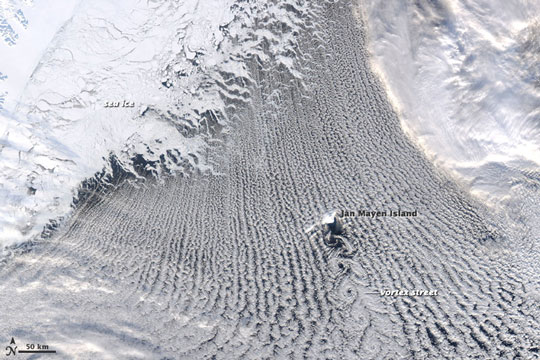
Cloud streets typically form fairly straight lines over large flat areas such as the ocean. However, geological features like islands can disrupt the flow of the wind and create spiral patterns in the cloud streets similar to the way in which large boulders create downstream eddies in rivers. The spiral patterns in clouds are called von Karman vortex streets. These vortices were named after Theodore von Kármán, a co-founder of NASA’s Jet Propulsion Laboratory, who was one of the first scientists to describe this type of atmospheric phenomenon.

Meteorological phenomena such as cloud streets and von Karman vortices are a manifestation of Earth’s atmosphere in motion.

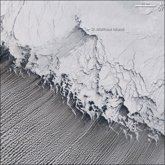
cloud-streets-bering-sea-20jan2006-540

The MODIS instrument on NASA’s Terra satellite captured these cloud streets over the Bering Sea on January 20, 2006. Image via Jesse Allen/NASA. Read more about this image.

von-karman-vortex-clouds-nasa-24feb2009-540

The MODIS instrument on NASA’s Aqua satellite acquired this image of a von Karman vortex that formed off the coast of Greenland on February 24, 2009. Image via Jeff Schmaltz, MODIS Rapid Response Team. Read more about this image.

Morning cloud streets over Vancouver Island. Image via CTV News Vancouver Island.

Most photos of cloud streets are taken by satellites orbiting high above Earth. This aerial image comes from Rosimar Rios Berrios, via NOAA's Hurricane Research Division

Clouds streets are most readily seen in satellite photography, but this aerial image comes from Rosimar Rios Berrios, via NOAA’s Hurricane Research Division.

Bottom line: Cloud streets are long rows of cumulus clouds oriented parallel to the direction of the wind.


from EarthSky https://ift.tt/1bVTM87

How do hurricanes get their names?

The Atlantic hurricane season begins on June 1 and ends November 30.

Ever wonder how hurricanes get their names? And why do hurricanes have names at all? Meteorologists long ago learned that naming tropical storms and hurricanes helps people remember the storms, communicate about them more effectively, and so stay safer if and when a particular storm strikes a coast. These experts assign names to hurricanes according to a formal list of names that is approved prior to the start of each hurricane season. The U.S. National Hurricane Center started this practice in 1950. Now, the World Meteorological Organization generates and maintains the list of hurricane names.

Here are the hurricane names for 2018:

Atlantic hurricane names are: Alberto, Beryl, Chris, Debby, Ernesto, Florence, Gordon, Helene, Isaac, Joyce, Kirk, Leslie, Michael, Nadine, Oscar, Patty, Rafael, Sara, Tony, Valerie, William. The Atlantic hurricane season runs from June 1 to November 30.

Eastern North Pacific hurricane names are: Aletta, Bud, Carlotta, Daniel, Emilia, Fabio, Gilma, Hector, Ileana, John, Kristy, Lane, Miriam, Norman, Olivia, Paul, Rosa, Sergio, Tara, Vicente, Willa, Xavier, Yolanda, Zeke. The eastern North Pacific hurricane season runs from May 15 to November 30.

If you’re interested, you can view those names, and names for upcoming years, here.

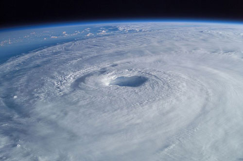
hurricane-isabel-nasa-500

Astronaut Ed Lu captured this view of Hurricane Isabel in 2003 from the International Space Station. Image via Mike Trenchard, NASA.

How and why did hurricanes first begin receiving names? While people have been naming major storms for hundreds of years, most hurricanes were originally designated by a system of latitude-longitude numbers, which was useful to meteorologists trying to track these storms. Unfortunately, this system was confusing to people living on coasts seeking hurricane information.

In 1950, a formal practice for storm naming was first developed for the Atlantic Ocean by the U.S. National Hurricane Center. At that time, storms were named according to a phonetic alphabet (e.g., Able, Baker, Charlie) and the names used were the same for each hurricane season; in other words, the first hurricane of a season was always named “Able,” the second “Baker,” and so on.

In 1953, to avoid the repetitive use of names, the system was revised so that storms would be given female names. By doing this, the National Weather Service was mimicking the habit of naval meteorologists, who named the storms after women, much as ships at sea were traditionally named for women.

In 1979, the system was revised again to include both female and male hurricane names.

See the complete history of naming hurricanes, from NOAA

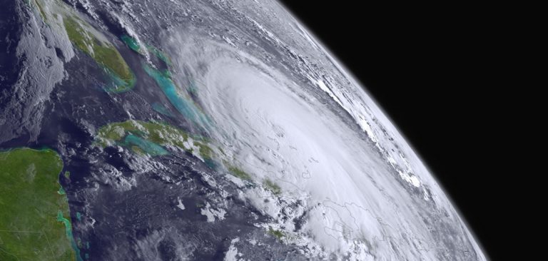
Hurricane Alex as seen on January 14, 2016, by the the Moderate Resolution Imaging Spectroradiometer (MODIS) on NASA’s Terra satellite. Image via NASA Earth Observatory.

When does a storm receive a name? Tropical storms are given names when they display a rotating circulation pattern and wind speeds of 39 miles per hour (63 kilometers per hour). A tropical storm develops into a hurricane when wind speeds reach 74 mph (119 kph).

Lists of hurricane names have been developed for many of the major ocean basins around the world. Today, there are six lists of hurricane names in use for Atlantic Ocean storms. These lists rotate, one each year. That means the list of this year’s hurricane names will come up again six years from now. There’s an exception to this practice, however. The names of hurricanes that are particularly damaging are retired for legal and historical reasons. For example, the use of the name Katrina was retired in 2005 following the devastating impact that Hurricane Katrina had on New Orleans. Likewise, the use of the name Harvey was retired in 2017 following the damaging floods that Hurricane Harvey caused in the Houston metropolitan area.

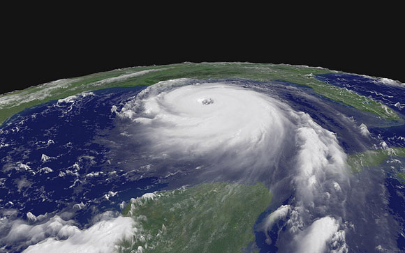
Hurricane Katrina on August 28, 2005. Image Credit: NASA.

Hurricane Katrina on August 28, 2005. Image via NASA.

Bottom line: Hurricanes are given names according to a formal system that is managed by the World Meteorological Organization. Hurricane names for 2018 are listed here.


from EarthSky https://ift.tt/1kHu4LC

See it! Young moon and Venus

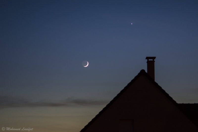
Mohamed Laaifat Photographies in France wrote: “Moon and Vénus tonight over my Normandy sky.”

Gianluca Masi caught Venus and the moon from Rome, Italy on May 17, 2018.

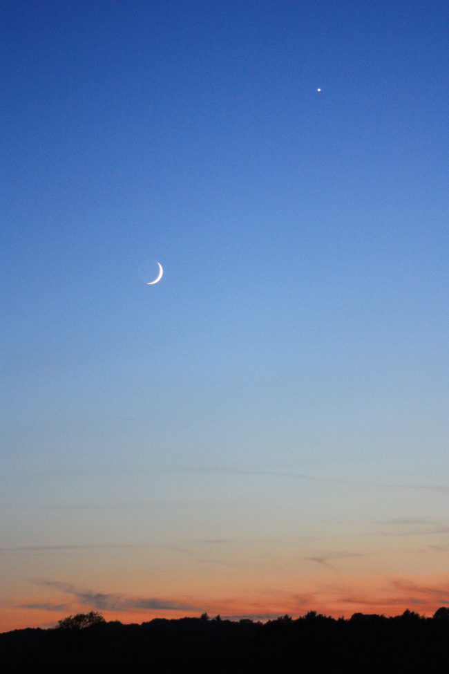
Isi Grefen caught Venus and the moon on May 17 from Gilling East, North Yorkshire, U.K.

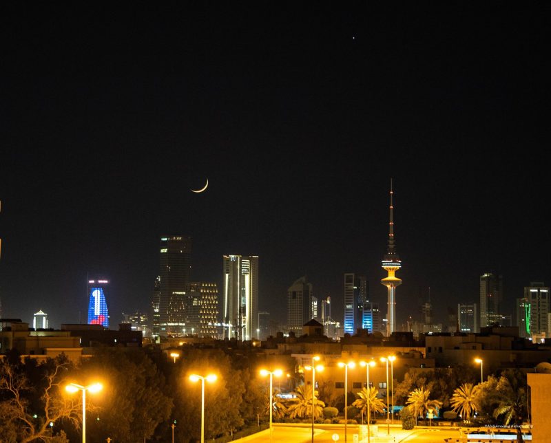
Abdulmajeed Alshatti captured this crescent moon – which marked the start of the Islamic holy month of Ramadan – from Kuwait City on May 17.

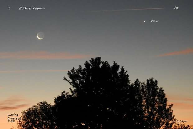
Michael Coonan caught Venus and the moon on May 17 from Wodonga, Australia.

Nikki Ellis caught Venus and the moon on May 17 from South Africa.

Chris Young in Indian Rocks Beach, Florida shot Venus and the moon with an iPhone on May 16, 2018.

Tanvi Javkar in Mississauga, Ontario, Canada caught Venus and the moon on May 16.


from EarthSky https://ift.tt/2IsqTb2

Moon and Gemini stars May 18 and 19

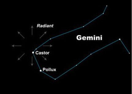
On May 18 and 19, 2018, you’ll find the waxing crescent the moon near Castor and Pollux, the two brightest stars in the constellation Gemini the Twins.

The other bright star on the other side of the moon is Procyon, the brightest in the constellation Canis Minor the Lesser Dog.

The queen planet Venus, which outshines all the bright stars, beams lower down in the sky and close to the horizon at nightfall. Be sure to catch Venus as soon as darkness falls, because this dazzling world will sink below the horizon by early evening.

Brightest planet Venus over Ghajn Tuffieha Bay, Malta on May 15, 2018. Image via Gilbert Vancell Nature Photography.

Both Castor and Pollux are bright stars, and they’ve been known as Twins for centuries at least. But they don’t really look alike.

Pollux is golden in color, and Castor is pure white. If you have binoculars, they’ll help you to more easily distinguish the color contrast between Castor and Pollux.

Also, Castor and Pollux are different kinds of stars. Castor is a hot, white-colored star that is well known for being a multiple system. It consists of three pairs of binary stars, that is, six stars bound together in an intricate gravitational dance. Pollux is a cool and bloated orange-colored star, said to be the closest giant star to Earth. A star swells up into a giant in its old age.

The moon passes in front of Gemini for a few days every month. The sun, on the other hand, passes in front of Gemini for one month each year, from about June 21 to July 20.

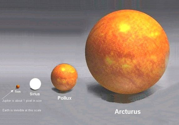
You can see the comparative size of the star Pollux and our sun in this image, as well as some other stars. Pollux is a giant star by virtue of its age. Many stars – including our sun – will swell to the giant stage as they age.

Castor and Pollux are extremely noticeable in the night sky. No other two such bright stars appear so close together. Regardless of the seeming connection between these two stars, Castor and Pollux aren’t close together in space. They just happen to reside along the same line of sight from Earth.

In many cultures, Castor and Pollux were seen as twin stars, usually as heroes. Many old sky myths invoke the idea of twins to explain their proximity on the sky’s dome.

EarthSky astronomy kits are perfect for beginners. Order today from the EarthSky store

If you have a dark sky, notice that 2 nearly parallel streams of stars extend from Castor and Pollux. These stars likely reinforced the idea of twins, in various cultures around the world. Every December, the Geminid meteor shower radiates from near star Castor in Gemini.

In Greek and Roman mythology, Castor and Pollux were the twin sons of Jupiter and Leda and brothers of Helen of Troy. They sailed with Jason as two of his Argonauts.

Pollux, represented by the brighter star, was immortal, but his brother Castor was not. When Castor was killed in a fight, Jupiter wanted the two to remain together, so he decreed that they each should spend some time in the underworld and some time in the heavens. This is a fanciful way of explaining why the constellation is above the horizon for part of each day and below the horizon for the rest. Castor and Pollux are sometimes said to represent brotherly love.

Meanwhile, in China, these two stars were associated with water, as part of constellations representing rivers. They were sometimes also seen as the complementary elements of yin and yang.

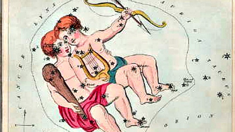
Castor and Pollux mark the starry eyes of the Gemini Twins. Image via Wikipedia.

Bottom line: The moon is near the stars Castor and Pollux in the constellation Gemini the Twins on May 18 and 19, 2018. These stars represent twins in many cultures.

Enjoying EarthSky so far? Sign up for our free daily newsletter today!

Donate: Your support means the world to us


from EarthSky https://ift.tt/1QmoUnz

Wall-E and Eva set record, snag pic

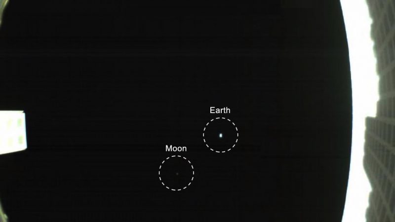
This is the 1st distant image of the Earth and moon ever captured by a CubeSat. MarCO-B – nicknamed Wall-E by spacecraft engineers at NASA’s Jet Propulsion Laboratory – acquired this image on May 9, 2018. Image via NASA JPL.

The Voyager 1 spacecraft took a classic portrait of Earth – the famous Pale Blue Dot image – from several billion miles away in 1990. On May 9, 2018, two tiny, boxy spacecraft known as CubeSats – nicknamed Wall-E and Eva by spaceflight engineers at NASA’s Jet Propulsion Laboratory in Pasadena, California – took their own version of a pale blue dot image, capturing Earth and its moon in one shot.

This is the Mars Cube One or MarCO mission, launched on May 5 along with NASA’s InSight lander. InSight will touch down on Mars this November and study the planet’s deep interior for the first time.

Artist’s concept of the twin MarCO spacecraft – called Wall-E and Eva by spaceflight engineers – as they fly through deep space. The MarCOs will be the first CubeSats to fly to another planet. They’re flying along behind NASA’s InSight lander on its cruise to Mars. If they make the journey, they’ll test a relay of data about InSight’s entry, descent and landing back to Earth. Image via NASA JPL.

The two little spacecraft are the first CubeSats ever to travel to interplanetary space. Most never go beyond Earth orbit; they generally stay below 497 miles (800 km) above the planet. Originally developed to teach university students about satellites, these modular mini-satellites are now a major commercial technology, providing data on everything from shipping routes to environmental changes.

On May 8, Wall-E and Eva set a new distance record (for CubeSats) when they reached 621,371 miles (~1 million km) from Earth. Then Wall-E – aka Mars Cube One B or MarCO-B – used a fisheye camera to snap its first photo on May 9. That photo – which you see above – is part of the process used by the engineering team to confirm the spacecraft’s high-gain antenna has unfolded properly.

Andy Klesh, the MarCO project’s chief engineer at JPL, said:

Consider it our homage to Voyager.

Awesome shot of Insight Mars launch – with the MarCos on board – on May 5, 2018. Despite fog at the launch site, photographer Alex Ustick in California was one of many who caught Insight climbing to space. Notice Jupiter!

NASA explained Wall-E and Eva’s role in the Insight mission:

The MarCO CubeSats will follow along behind InSight during its cruise to Mars. Should they make it all the way to Mars, they will radio back data about InSight while it enters the atmosphere and descends to the planet’s surface. The high-gain antennas are key to that effort; the MarCO team have early confirmation that the antennas have successfully deployed, but will continue to test them in the weeks ahead.

InSight won’t rely on the MarCO mission for data relay. That job will fall to NASA’s Mars Reconnaissance Orbiter. But the MarCOs could be a pathfinder so that future missions can “bring their own relay” to Mars. They could also demonstrate a number of experimental technologies, including their antennas, radios and propulsion systems, which will allow CubeSats to collect science in the future.

Later this month, NASA said, the MarCOs will attempt the first trajectory correction maneuvers ever performed by CubeSats. NASA explained:

This maneuver lets them steer towards Mars, blazing a trail for CubeSats to come.

Bottom line: The 1st-ever CubeSats – nicknamed Wall-E and Eva – set a new CubeSat distance record on May 8. Then Wall-E turned back and grabbed the first-ever CubeSat pale blue dot image: an image of the Earth and moon.

Via NASA JPL


from EarthSky https://ift.tt/2Gq0Z5C

adds 2