
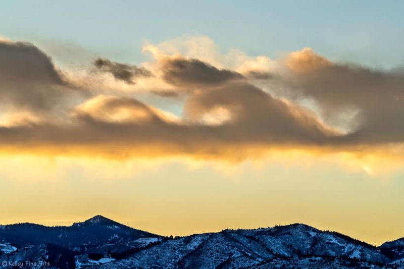
View at EarthSky Community Photos. | Suzanne Kelley of Littleton, Colorado caught these Kelvin-Helmholtz clouds – clouds that look like ocean waves – at sunset over the Rocky Mountains on New Year’s Eve, December 31, 2019. Thank you, Suzanne!
Here’s a collection of beautiful images of a special kind of cloud known to scientists as Kelvin-Helmholtz clouds. These clouds look like breaking ocean waves, with the rolling eddies seen at the top of the cloud layers. The eddies are usually evenly spaced, making the clouds easily identifiable.
Kelvin-Helmholtz clouds are named for Lord Kelvin and Hermann von Helmholtz, who studied the physics of the instability that leads to this type of cloud formation. A Kelvin-Helmholtz instability forms where there’s a velocity difference across the interface between two fluids: for example, wind blowing over water. You’ll often see the characteristic wave structure in this type of cloud when two different layers of air in our atmosphere are moving at different speeds. The upper layers of air are moving at higher speeds and will often scoop the top of the cloud layer into these wave-like rolling structures.
The clouds often form on windy days, when there’s a difference in densities of the air, for example, during a temperature inversion. They’re often good indicators of atmospheric instability and the presence of turbulence for aircraft.
It’s widely believed that these waves in the sky inspired the swirls in van Gogh’s masterpiece Starry Night.
Enjoy the photos!
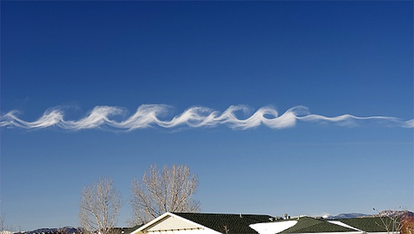
Surf in the sky via Yoav Naccache
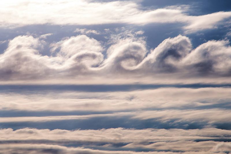
Kelvin-Helmholtz clouds seen in Tupper Lake, New York, in the Adirondack Mountains. Photo via Paul Chartier.
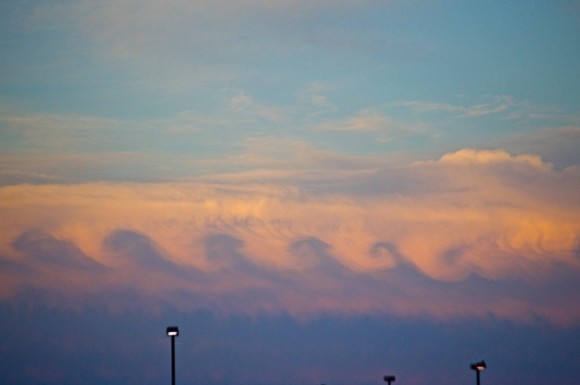
View larger. | EarthSky Facebook friend Risa Bender caught these Kelvin-Helmholtz clouds from Dallas, Texas.

Helio de Carvalho Vital caught these Kelvin-Helmholtz clouds over Rio de Janeiro, Brazil.
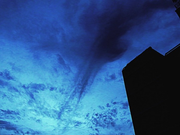
View larger. | Helio de Carvalho Vital also submitted this photo to EarthSky. It’s a Kelvin-Helmholtz effect in virga, or rain that falls but doesn’t reach the ground. He caught it in Rio de Janeiro, Brazil, on May 15, 2015.
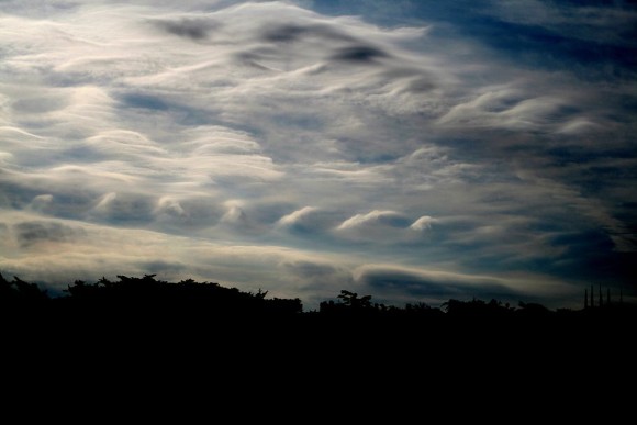
Kelvin-Helmholtz clouds seen over San Francisco. These clouds, sometimes called “billow clouds,” are produced by instability, when horizontal layers of air brush by one another at different velocities. Photo via Wikimedia Commons.
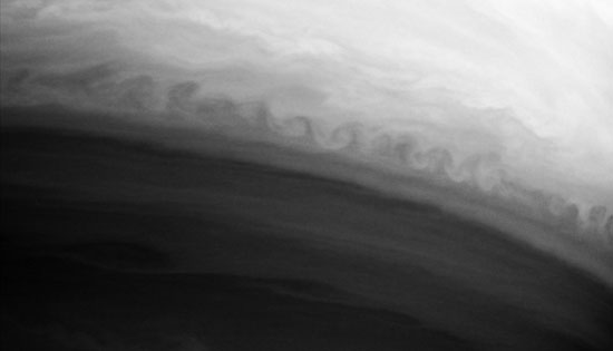
Earth isn’t the only planet with Kelvin-Helmholtz clouds. Here they are on Saturn; Jupiter has them, too. Image via Wikimedia Commons.
Bottom line: Kelvin-Helmholtz clouds – also called billow clouds – form when two different layers of air in our atmosphere are moving at different speeds.
from EarthSky https://ift.tt/2F7liXA


View at EarthSky Community Photos. | Suzanne Kelley of Littleton, Colorado caught these Kelvin-Helmholtz clouds – clouds that look like ocean waves – at sunset over the Rocky Mountains on New Year’s Eve, December 31, 2019. Thank you, Suzanne!
Here’s a collection of beautiful images of a special kind of cloud known to scientists as Kelvin-Helmholtz clouds. These clouds look like breaking ocean waves, with the rolling eddies seen at the top of the cloud layers. The eddies are usually evenly spaced, making the clouds easily identifiable.
Kelvin-Helmholtz clouds are named for Lord Kelvin and Hermann von Helmholtz, who studied the physics of the instability that leads to this type of cloud formation. A Kelvin-Helmholtz instability forms where there’s a velocity difference across the interface between two fluids: for example, wind blowing over water. You’ll often see the characteristic wave structure in this type of cloud when two different layers of air in our atmosphere are moving at different speeds. The upper layers of air are moving at higher speeds and will often scoop the top of the cloud layer into these wave-like rolling structures.
The clouds often form on windy days, when there’s a difference in densities of the air, for example, during a temperature inversion. They’re often good indicators of atmospheric instability and the presence of turbulence for aircraft.
It’s widely believed that these waves in the sky inspired the swirls in van Gogh’s masterpiece Starry Night.
Enjoy the photos!

Surf in the sky via Yoav Naccache

Kelvin-Helmholtz clouds seen in Tupper Lake, New York, in the Adirondack Mountains. Photo via Paul Chartier.

View larger. | EarthSky Facebook friend Risa Bender caught these Kelvin-Helmholtz clouds from Dallas, Texas.

Helio de Carvalho Vital caught these Kelvin-Helmholtz clouds over Rio de Janeiro, Brazil.

View larger. | Helio de Carvalho Vital also submitted this photo to EarthSky. It’s a Kelvin-Helmholtz effect in virga, or rain that falls but doesn’t reach the ground. He caught it in Rio de Janeiro, Brazil, on May 15, 2015.

Kelvin-Helmholtz clouds seen over San Francisco. These clouds, sometimes called “billow clouds,” are produced by instability, when horizontal layers of air brush by one another at different velocities. Photo via Wikimedia Commons.

Earth isn’t the only planet with Kelvin-Helmholtz clouds. Here they are on Saturn; Jupiter has them, too. Image via Wikimedia Commons.
Bottom line: Kelvin-Helmholtz clouds – also called billow clouds – form when two different layers of air in our atmosphere are moving at different speeds.
from EarthSky https://ift.tt/2F7liXA

Aucun commentaire:
Enregistrer un commentaire